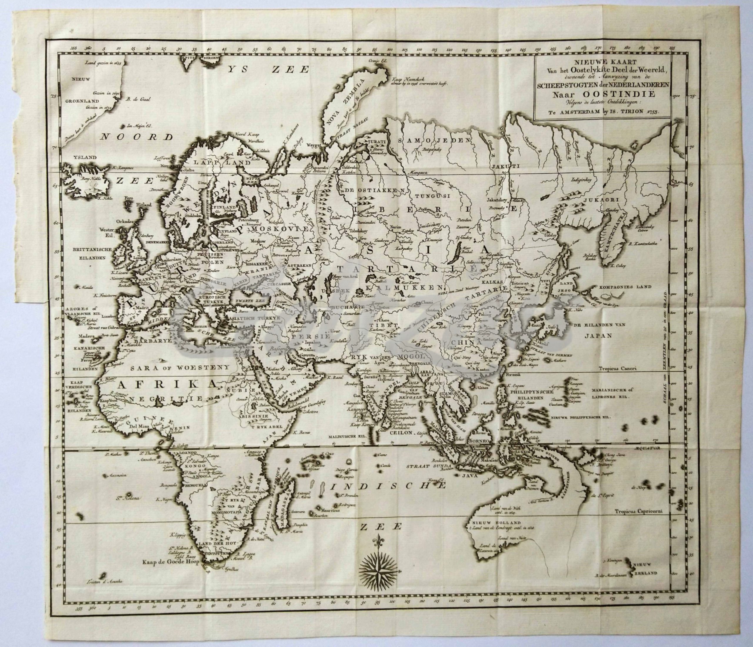
Beschrijving
Map of the eastern hemisphere, from Europe and Iceland to Siberia and Indonesia, with the then discovered coast of Australia.
Engraving on hand laid paper, sheet size 403 x 348 mm., platemark 370 x 324 mm. Engraving published by Is. Tirion in Amsterdam, 1753. This map originates from the multi-volume publication 'Hedendaagsche Historie, of Tegenwoordige Staat van alle volken', published by Is. Tirion.
In very good condition, multiple folds, as issued.